
In today’s rapidly evolving technological landscape, digital mapping services have emerged as an indispensable tool that revolutionizes the way we interact with and understand our world. This article delves into the intricate realm of digital mapping, uncovering its applications, benefits, challenges, and the role it plays in shaping various industries.
Introduction
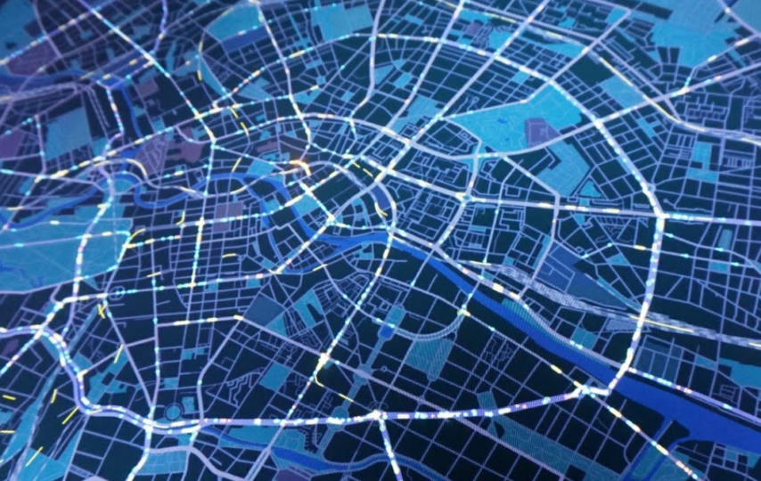
Digital mapping, a marriage of geographical information and cutting-edge technology, has reshaped the way we perceive and interact with our surroundings. As we embark on this journey to explore the nuances of digital mapping, we’ll unravel the layers of its functionality, benefits, challenges, and its far-reaching implications across industries.
Understanding Digital Mapping
What is Digital Mapping?
At its core, digital mapping involves the process of converting real-world geographic information into a digital format, allowing for visualization, analysis, and manipulation. It blends cartography, geospatial analysis, and technology to create interactive and dynamic maps that offer a wealth of insights.
Evolution of Digital Mapping Technology
From hand-drawn maps to the sophisticated digital tools we have today, the evolution of digital mapping technology is a testament to human ingenuity. Early digital maps were basic and limited, but advancements in computing power, satellite technology, and data collection methods have paved the way for highly detailed and accurate maps.
Key Components of Digital Mapping
Geographic Information Systems (GIS)
GIS forms the backbone of digital mapping. It’s a system designed to capture, store, analyze, and present geospatial data. By overlaying various layers of information on a single map, GIS enables us to identify patterns, relationships, and trends that might otherwise remain hidden.
Global Positioning System (GPS)
GPS, a constellation of satellites orbiting Earth, allows for precise location tracking. From navigating through unfamiliar terrain to tracking vehicles in real-time, GPS plays a pivotal role in digital mapping by providing accurate positioning information.
Remote Sensing
Remote sensing involves collecting data from a distance, often through satellites or drones. This technology aids in gathering information about Earth’s surface, atmosphere, and oceans, contributing essential data for creating comprehensive digital maps.
Applications of Digital Mapping
Navigation and Wayfinding
Gone are the days of paper maps and asking for directions. Digital mapping has transformed navigation, providing real-time route guidance, traffic updates, and even indoor navigation within large complexes like airports and malls.
Urban Planning and Development
Cities are dynamic, ever-changing entities. Digital mapping with the help of aerial lidars, assists urban planners in visualizing potential developments, optimizing infrastructure, and making informed decisions about land use.
Environmental Management
Monitoring and managing the environment is a complex task. Digital maps help track deforestation, monitor wildlife habitats, and analyze changes in landscapes, aiding in effective conservation efforts.
Disaster Response and Recovery
During natural disasters, every second counts. Digital mapping facilitates quick response by providing real-time information about affected areas, enabling efficient resource allocation and evacuation plans.
Business Intelligence and Market Analysis
For businesses, location data is invaluable. Digital maps offer insights into consumer demographics, preferences, and behaviors, aiding in targeted marketing and strategic decision-making.
Benefits of Digital Mapping
Enhanced Visualization
Visual information is more digestible than raw data. Digital mapping transforms complex data sets into visual representations, making it easier to identify trends and patterns at a glance.
Data Integration and Analysis
Digital maps serve as a hub for integrating diverse data sources. This integration allows for more comprehensive analysis, leading to informed conclusions and actionable insights.
Improved Decision-Making
Informed decisions are the bedrock of success. Digital mapping empowers individuals and organizations to make decisions grounded in spatial context and data-driven insights.
Challenges in Digital Mapping
Data Privacy and Security Concerns
As maps become more personalized and detailed, safeguarding sensitive location data becomes crucial to prevent misuse and breaches of privacy.
Data Accuracy and Quality
The accuracy of digital maps hinges on the quality of the data they’re built upon. Inaccurate or outdated information can lead to misguided decisions and navigation errors.
Accessibility and Infrastructure Limitations
Not all regions have the same level of digital infrastructure. Disparities in accessibility to digital maps can exacerbate inequalities, hindering their widespread benefits.
Future Trends in Digital Mapping
3D and Augmented Reality Mapping
The future of digital mapping lies in creating immersive experiences. 3D and augmented reality maps promise to provide a deeper understanding of spaces, allowing for more intuitive exploration.
Real-time Data Updates
Dynamic environments require real-time updates. The ability to update maps instantly with fresh data will be a game-changer for applications like traffic management and disaster response.
AI and Machine Learning Integration
Artificial intelligence and machine learning will enhance the analytical capabilities of digital maps, enabling predictive modeling, pattern recognition, and more accurate insights.
Digital Mapping in Various Industries
Healthcare
In healthcare, digital mapping assists in tracking disease outbreaks, planning medical facilities, and optimizing emergency response routes.
Transportation
From autonomous vehicles to efficient logistics, digital maps underpin advancements in transportation technology.
Agriculture
Precision agriculture benefits from digital mapping by optimizing crop management, resource allocation, and monitoring soil health.
Tourism
Digital maps make exploring new destinations more interactive and engaging, enhancing the travel experience.
How to Get Started with Digital Mapping
Choosing the Right Mapping Software
Selecting the appropriate mapping software depends on your goals and level of expertise. Popular options include ArcGIS, QGIS, and Google Earth.
Acquiring and Processing Geospatial Data
Accurate maps require quality data. Sources include satellite imagery, aerial photography, and open data repositories.
Creating Custom Maps
Tailor your maps to your needs. Add custom layers, annotations, and interactive elements to create maps that convey your specific message.
Conclusion
Digital mapping has transcended the realm of novelty to become an essential tool for individuals, businesses, and governments. Its ability to visualize complex data, offer insights, and guide decisions has reshaped various industries and continues to pave the way for innovation. As technology evolves and more data becomes available, the potential applications of digital mapping are limitless.
FAQs
What is digital mapping used for?
Digital mapping is used for navigation, urban planning, environmental monitoring, disaster response, business analysis, and more.
How accurate are digital maps?
The accuracy of digital maps varies based on the quality of data sources and the technology used for mapping.
Is digital mapping secure?
Ensuring the security of location data is a concern, and measures are taken to protect user privacy.
Can I create my own digital maps?
Yes, various mapping software allows users to create custom digital maps tailored to their needs.
What does the future hold for digital mapping? The future involves 3D mapping, real-time updates, and integration with AI, opening new possibilities for exploration and analysis.